Maps and geographic views
Geographic points, regions, routes, GeoJSON shapes and illustrated maps.
Open Add widget and choose the exact tile name below. Standard tiles use a base renderer. Specialized widget tiles preload that renderer’s specialized view, field mappings and starter data. Both are editable in Studio. Read the shared data, styling and interaction guide before replacing starter data.
Screenshots. These are real Studio widgets with fictional sample data and example settings. Colors, labels and layout remain configurable. Select an image to view it at full size.
Map
Standard · Picker tile map
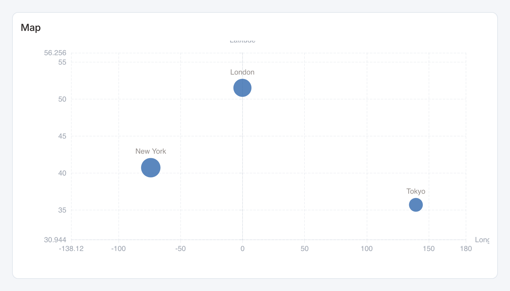
Required data and grain. One row per geographic point. Bind longitude, latitude, value and label. Named longitude aliases are longitude/lng/lon and latitude aliases are latitude/lat. Positional fallback is longitude then latitude.
| Example field | Type | Role in this example |
|---|---|---|
longitude | Number | Required |
latitude | Number | Required |
value | Number | Required |
name | Text | Optional / available to map |
Optional fields and bindings. The example uses name as the label. An explicit label mapping can use another field.
Example result.
longitude | latitude | value | name |
|---|---|---|---|
-74.01 | 40.71 | 1000 | New York |
-0.13 | 51.51 | 850 | London |
139.69 | 35.69 | 600 | Tokyo |
Download the complete data example. Select this tile to load its preset settings, then use these column names in the visual builder or the example query.
Styling controls. Map controls set field bindings, palette, marker size, labels and view. Longitude must be between -180 and 180 and latitude between -90 and 90.
Interactions. Hover points to inspect values. Use Geographic point map for the configurable layer renderer and explicit stable-key selection.
Check before publishing. Coordinates are degrees in longitude/latitude order. A place name by itself is not geocoded by this widget.
Lines (Geo)
Standard · Picker tile lines
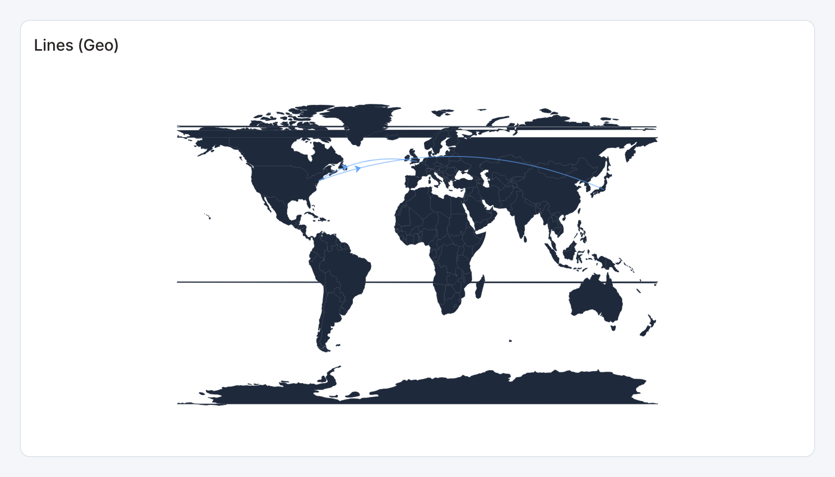
Required data and grain. One row per route. Columns are label, source longitude, source latitude, target longitude, target latitude and numeric value.
| Example field | Type | Role in this example |
|---|---|---|
label | Text | Required |
src_lng | Number | Required |
src_lat | Number | Required |
tgt_lng | Number | Required |
tgt_lat | Number | Required |
value | Number | Required |
Optional fields and bindings. Use valid degree coordinates and a consistent route weight.
Example result.
label | src_lng | src_lat | tgt_lng | tgt_lat | value |
|---|---|---|---|---|---|
NYC->LON | -74.0 | 40.7 | -0.1 | 51.5 | 100 |
NYC->TYO | -74.0 | 40.7 | 139.7 | 35.7 | 80 |
Download the complete data example. Select this tile to load its preset settings, then use these column names in the visual builder or the example query.
Styling controls. Set palette, labels and map view. Give dense routes enough space to avoid hiding endpoints.
Interactions. Hover for values where a tooltip is shown. This renderer does not send mark selections to dashboard filters or drill-through.
Check before publishing. Routes connect coordinates directly. The widget does not calculate street routes or travel times. The widget loads its bundled world boundaries before drawing routes, including on a fresh page. A loading message appears while boundaries load, with a retry control if loading fails.
Choropleth
Standard · Picker tile choropleth
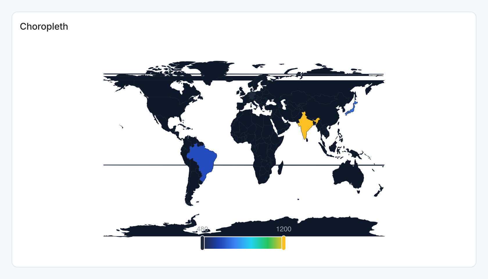
Required data and grain. One row per country. First column is a country name matching the bundled world geometry, second numeric value.
| Example field | Type | Role in this example |
|---|---|---|
region | Text | Required |
value | Number | Required |
Optional fields and bindings. Use names such as United States, France and Germany. Unmatched names do not acquire a shape.
Example result — first three rows.
region | value |
|---|---|
United States | 1000 |
Brazil | 650 |
India | 1200 |
Download the complete data example. Select this tile to load its preset settings, then use these column names in the visual builder or the example query.
Styling controls. Set value colors, labels and map view.
Interactions. Hover for values where a tooltip is shown. This renderer does not send mark selections to dashboard filters or drill-through.
Check before publishing. Use Filled area map for layer controls and linked selection, or GeoJSON area map for your own boundaries.
Illustrated map
Specialized widget · Picker tile illustrated-map
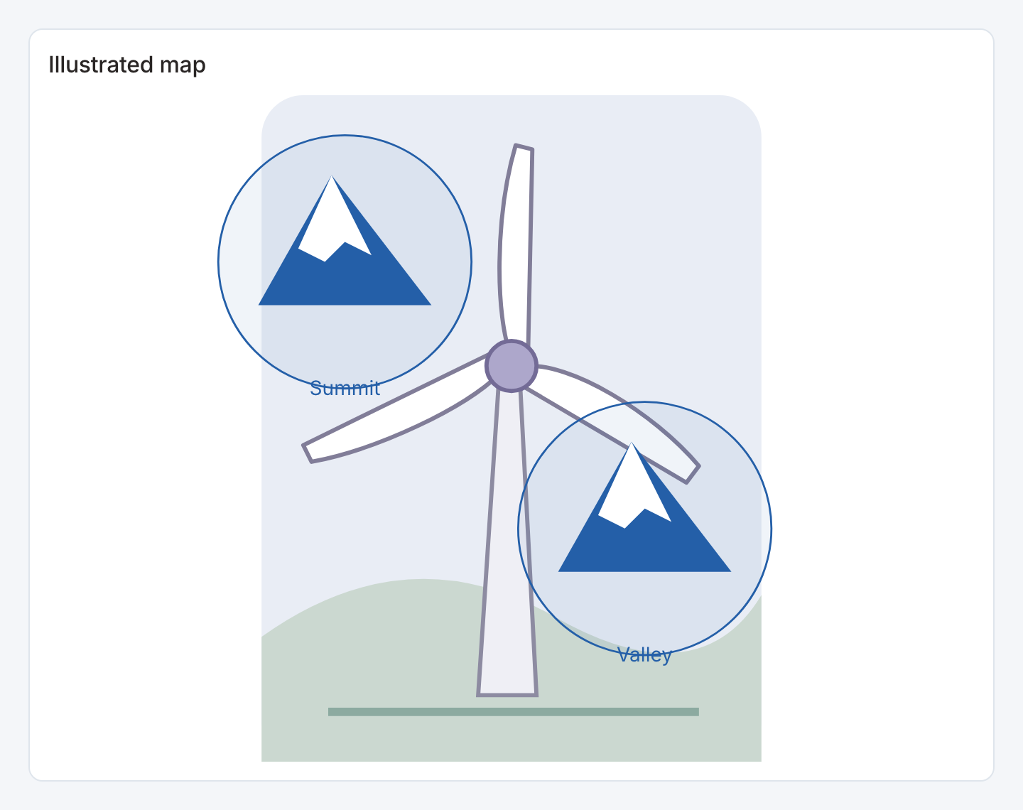
The example uses an illustration background. Upload your own image and position the markers with the widget controls.
Required data and grain. One row per marker, with a label, normalized diagram x/y coordinates and a numeric value.
| Example field | Type | Role in this example |
|---|---|---|
name | Text | Required |
x | Number | Required |
y | Number | Required |
value | Number | Optional / available to map |
Optional fields and bindings. Upload or configure the illustration background. Marker actions send the name field, so use distinct names for independent selections. The value field remains available in the data table but does not size these markers.
Example result.
name | x | y | value |
|---|---|---|---|
Summit | 25 | 25 | 120 |
Valley | 70 | 65 | 90 |
Download the complete data example. Select this tile to load its preset settings, then use these column names in the visual builder or the example query.
Styling controls. Set image, alternate text, marker shape and fixed size, colors, label size and frame.
Interactions. Select a marker with pointer or keyboard for a configured action.
Check before publishing. Coordinates are positions on the illustration, on a 100-by-100 canvas. The renderer clamps x to 5–95 and y to 5–90. These are diagram positions rather than longitude and latitude.
Geographic point map
Specialized widget · Picker tile point-map
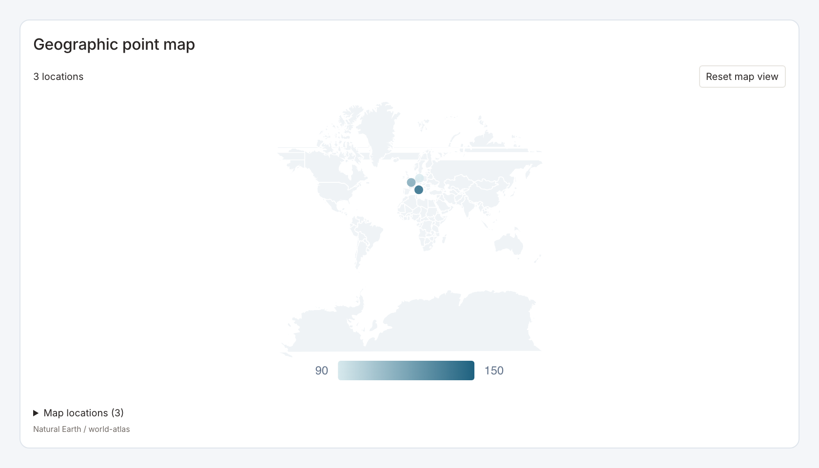
Required data and grain. One row per point, with a stable key, display label, longitude, latitude and numeric value.
| Example field | Type | Role in this example |
|---|---|---|
id | Text | Required |
name | Text | Required |
longitude | Number | Required |
latitude | Number | Required |
value | Number | Required |
Optional fields and bindings. The selection key may differ from the display label. Use valid degree coordinates.
Example result.
id | name | longitude | latitude | value |
|---|---|---|---|---|
Paris | Paris | 2.35 | 48.86 | 120 |
Berlin | Berlin | 13.4 | 52.52 | 90 |
Rome | Rome | 12.5 | 41.9 | 150 |
Download the complete data example. Select this tile to load its preset settings, then use these column names in the visual builder or the example query.
Styling controls. Layer controls set point mode, fields, marker size and shape, size-by-value, colors, labels, search, pan/zoom and bounds. Bundled world geometry supplies geographic context.
Interactions. Search for a point, pan/zoom and select its configured stable key for filtering or drill-through.
Check before publishing. Place names are not geocoded. Longitude precedes latitude. Check a known point before adding an entire dataset.
Street point map
Specialized widget · Picker tile street-point-map
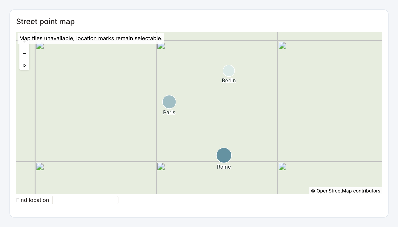
Point markers are shown without external street tiles. A permitted tile provider is needed for the street background.
Required data and grain. One row per point, with a stable key, display label, longitude, latitude and numeric value.
| Example field | Type | Role in this example |
|---|---|---|
id | Text | Required |
name | Text | Required |
longitude | Number | Required |
latitude | Number | Required |
value | Number | Required |
Optional fields and bindings. The selection key may differ from the display label. Use valid degree coordinates.
Example result.
id | name | longitude | latitude | value |
|---|---|---|---|---|
Paris | Paris | 2.35 | 48.86 | 120 |
Berlin | Berlin | 13.4 | 52.52 | 90 |
Rome | Rome | 12.5 | 41.9 | 150 |
Download the complete data example. Select this tile to load its preset settings, then use these column names in the visual builder or the example query.
Styling controls. Layer controls set point mode, fields, marker size and shape, size-by-value, colors, labels, search, pan/zoom and bounds. Choose a permitted street basemap provider and attribution.
Interactions. Search for a point, pan/zoom and select its configured stable key for filtering or drill-through.
Check before publishing. Place names are not geocoded. Street tiles need a provider permitted by the deployment image policy. External tiles are currently blocked on staging, so markers can work while the street background remains unavailable.
Filled area map
Specialized widget · Picker tile area-map
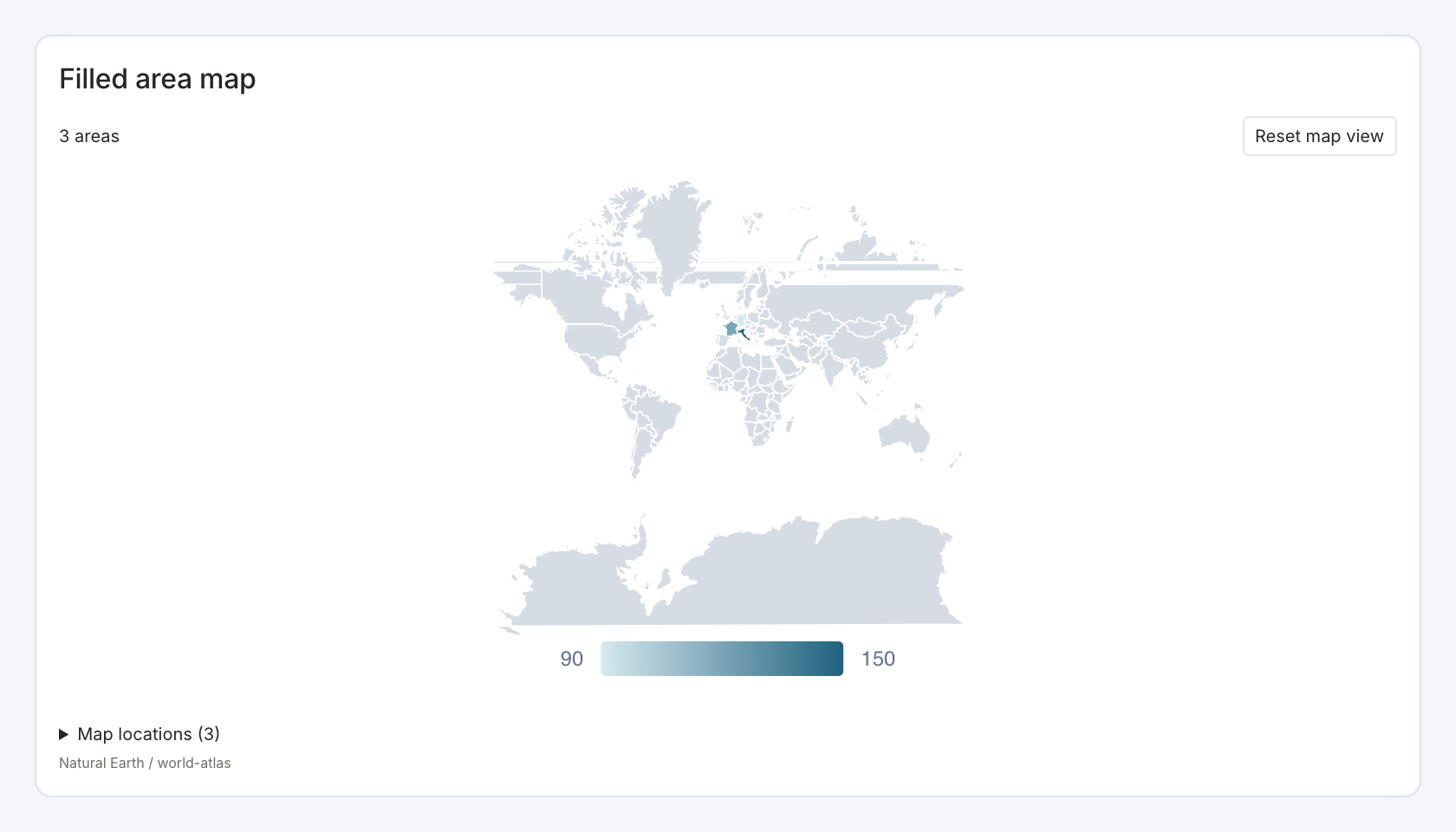
Required data and grain. One row per area, with an ID matching bundled geometry, a name and numeric value.
| Example field | Type | Role in this example |
|---|---|---|
id | Text | Required |
name | Text | Required |
value | Number | Required |
Optional fields and bindings. Use a distinct selection key if necessary and confirm name/ID matching against the chosen geometry.
Example result.
id | name | value |
|---|---|---|
France | France | 120 |
Germany | Germany | 90 |
Italy | Italy | 150 |
Download the complete data example. Select this tile to load its preset settings, then use these column names in the visual builder or the example query.
Styling controls. Choose area mode, geometry source, color scale or fixed fill, labels, selected fill, search, map bounds and pan/zoom.
Interactions. Search and select an area for a configured action.
Check before publishing. The example uses France and Germany. Unmatched area keys do not create geometry. Use GeoJSON area map for boundaries absent from the bundled geometry.
GeoJSON area map
Specialized widget · Picker tile geojson-map
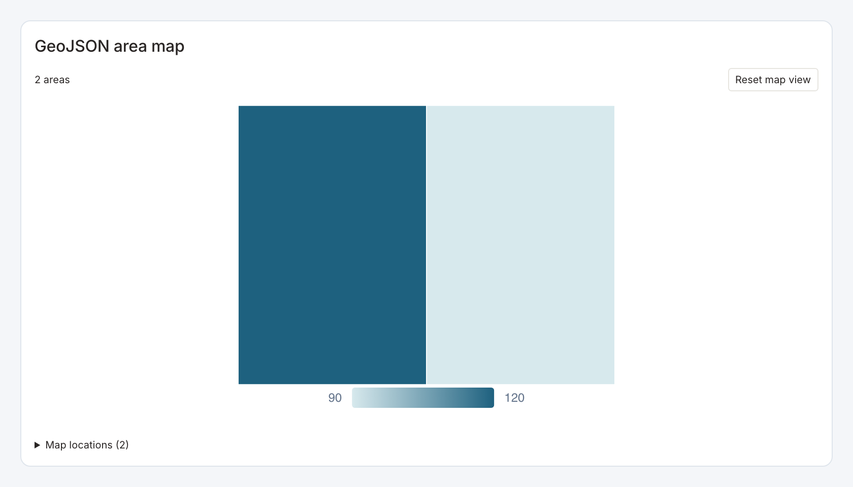
Required data and grain. One row per feature, with stable ID, label, value and a valid GeoJSON geometry string.
| Example field | Type | Role in this example |
|---|---|---|
id | Text | Required |
name | Text | Required |
value | Number | Required |
geometry_json | GeoJSON text | Required |
Optional fields and bindings. Bind the geometry field explicitly. Polygon rings must be closed and coordinates use longitude/latitude order.
Example result.
id | name | value | geometry_json |
|---|---|---|---|
A | Illustrative area A | 120 | {"type":"Polygon","coordinates":[[[-122.5,47.5],[-122.3,47.5],[-122.3,47.7],[-122.5,47.7],[-122.5… |
B | Illustrative area B | 90 | {"type":"Polygon","coordinates":[[[-122.3,47.5],[-122.1,47.5],[-122.1,47.7],[-122.3,47.7],[-122.3… |
Download the complete data example. Select this tile to load its preset settings, then use these column names in the visual builder or the example query.
Styling controls. Set query geometry source, area/point mode as appropriate, colors, outlines, labels, search, bounds and selected fill.
Interactions. Pan/zoom, search and select a feature key for a configured linked action.
Check before publishing. The example contains two fictional adjacent polygons. Provide geometry objects in the mapped field, not an unbound file path or an unrelated table column.
GeoJSON shape gallery
Specialized widget · Picker tile shape-gallery
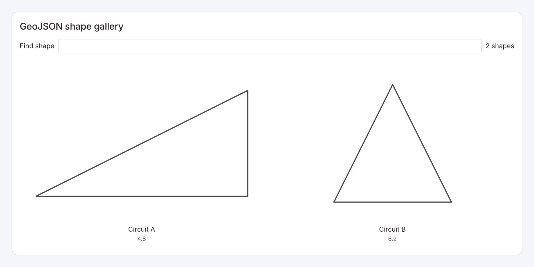
Required data and grain. One row per shape, with stable ID, label, numeric display value and GeoJSON geometry string.
| Example field | Type | Role in this example |
|---|---|---|
id | Text | Required |
name | Text | Required |
value | Number | Required |
geometry_json | GeoJSON text | Required |
Optional fields and bindings. The example uses LineString circuits. Valid polygon shapes can also be supplied.
Example result.
id | name | value | geometry_json |
|---|---|---|---|
circuit-a | Circuit A | 4.8 | {"type":"LineString","coordinates":[[0,0],[2,0],[2,1],[1,0.5],[0,0]]} |
circuit-b | Circuit B | 6.2 | {"type":"LineString","coordinates":[[0,0],[1,2],[2,0],[0,0]]} |
Download the complete data example. Select this tile to load its preset settings, then use these column names in the visual builder or the example query.
Styling controls. Choose gallery layout, columns, gap, stroke width, fixed or value color, labels, values and selected styling.
Interactions. Select a gallery shape for a configured key-based action.
Check before publishing. Each shape is fitted independently. Its on-screen size does not compare real-world scale, area or route length. The numeric value must be supplied by the source.